About Killarney Provincial Park
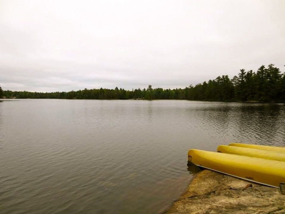
Crystal clear lakes, bright white quartzite peaks and the call of the loon while the sun sets; Killarney Provincial Park is a place of beauty that holds a special spot in our hearts. Below we share camping and canoeing tips and trail overviews to help plan your trip to our beloved Park.
Making a reservation? Questions about the Park? Ontario Parks is your official resource on Killarney Park.
Making a reservation? Questions about the Park? Ontario Parks is your official resource on Killarney Park.
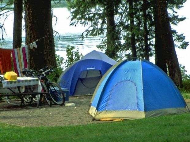
Car Camping on George LakeKillarney Provincial Park has one beautiful campground at the George Lake access point. It is a quiet, family-oriented area with a comfort station. In summer, you can swim at the beaches and access the many hiking trails. In winter, you can cross-country ski, snowshoe and hike.
Interior CampingYou can paddle or hike to your backcountry destination. Canoe trippers have a choice of over 40 interconnected lakes to paddle, and backpackers have a choice of 45 hike-in sites along.
Canoe rentals are available at these locations: CANOEING TIPS
Learn how to use a map and compass and keep them with you. Be aware that campsite and portage signs are small and navigation is required to reach them. Use the map scale to estimate traveling time. Consider the distance and difficulty of portages. Remember, on the map, closely grouped contour lines indicate steeper hills. An average paddler can maintain a speed of 3 km/hr. Adjust this estimate according to your group's experience. Be aware that water levels change throughout the paddling season. Check with staff for information on current conditions. Be aware of weather conditions. You can receive weather forecasts when you obtain your permit. Be aware that winds can be strong in the backcountry. Backcountry tips
Be aware of the physical abilities of your group and respect your limits. You are responsible for your health and safety. Learn how to use a map and compass, and always have them with you when you hike. Choose your route wisely. Average backpackers cover 8 to 10 km/day depending on the terrain. Consider the topography when deciding how far you want to hike in a day. When in doubt, choose the shorter day (it's better to arrive early, than to arrive late and exhausted). Know how much weight you can carry for extended periods. If you have not carried a multi-day backpack before, take a trial run at home. Pack up all the gear you plan to bring and head for a walk to see if you've overestimated. For safe, enjoyable hiking, you should carry no more that 15-18 kg (35-40 pounds). Walk in single-file on trails, even through muddy sections, to avoid widening the trail. Avoid encounters with animals. Clean up properly after meals, never take food, soap, toothpaste, vitamins or scented products into your tent. Hang your pack with your food and garbage well away from the tent area. |
|
Park Trails
Explore Killarney Provincial Park, and the surrounding area, by hiking its many trails in any season.
Below, we give you an overview of each trail including access points, length and level of difficulty.
Below, we give you an overview of each trail including access points, length and level of difficulty.
|
Hiking Trails
Chikanishing trail
1.5 hours | 3 km | Moderate Overview: Passes over a series of small ridges and ends at the Park's southern boundary of Georgian Bay. Access: Begins at the end of Chikanishing Road (2 km west of the Park office) at the main boat launch. GRANITE RIDGE Trail
1.25 hours | 2.3 km | Moderate Overview: Leads hikers up to exposed rock ridges with sweeping views of Georgian Bay and the La Cloche Mountains. Begins along the shoreline of glacial Lake Nipissing, which can be traced back to the George Lake campground. Access: Starts on the south side of Hwy 637, directly across from the Park office. The Crack Trail
3 hours | 6 km | Moderate-Difficult Overview: Leads hikers to a stunning view from the top of Killarney Ridge. White cliffs of the La Cloche Mountains surround you as you ascend through "the Crack", climbing up and over the cascade of huge tumbled boulders. Once you reach the top, you will be treated to beautiful panoramic vistas. Access: Begins through an old logging road located 7.1 km east of the Park office. The access road is unmarked, so you will need to watch your odometer as you drive. Cranberry Bog
2 hours | 4 km | Moderate Overview: Leads hikers past the Park's wet and dry environments. Begins at Proulx Marsh (the last wetlands to empty into George Lake) and continues through a Cattail Marsh to the Cranberry Bog. Access: Starts from the campground road, near site 101 Lake of Woods
3 hours | 3.5 km | Difficult Overview: Travels through many forest types including old growth stands and elevated outcrops. The outcrops offer excellent views of Silver Peak and Lake of the Woods. At one point, the trail descends to the lakeshore where a short boardwalk connects to the lake's only island. Access: From Bell Lake Road (21 km east of Park office). Drive on Bell Lake Road for 7 km. The access to the Lake of the Woods Trail is on the left hand side of the road, across from the portage into Turbid Lake. LA CLOCHE SILHOUETTE TRAIL GUIDE
7-9 days | 80 km | Difficult Overview: A challenging trail that demands good physical condition and a high degree of hiking ability. Hikers should be equipped for a week to cover the trail's approximate 80 km. Ski Trails
Chikanishing trail
7 km | flat terrain | beginner Overview: Follows campground roads along Chikanishing Creek. Trailhead: Park Office freeland trails
11.5 km | Flat Terrain | All Levels Leaves from the Bobcat section of the campground and finishes at east-end of Freeland Lake. Trailhead: Park Office Collins Inlet trail
14 km | Flat terrain, steep pitches | Experienced Passes through many ecosystems including mature forests to marshlands. |
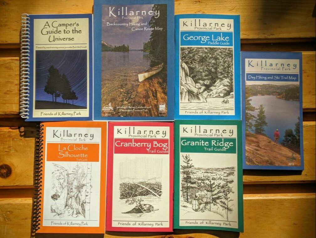
Maps & GuidesVisit our online store for Killarney Provincial Park
trail guides and maps. |